
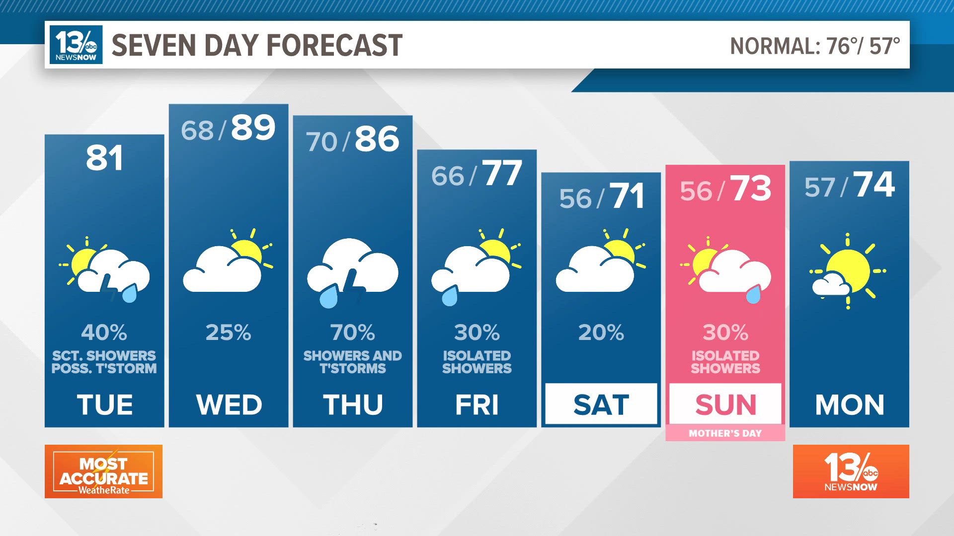
NORFOLK, Va. — A few isolated showers popped up Tuesday afternoon, but any leftover showers will diminish after sunset, leading to a dry night. It will be humid, however, with morning temperatures in the middle 60s.
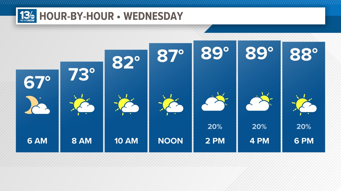
As southwest winds kick in Wednesday, it looks to be the hottest temperatures of the week. Most locations should see temperatures around 90°, with some spots even in the lower 90s. The combination of heat and humidity will once again give us the chance of isolated, late-day showers and thunderstorms.

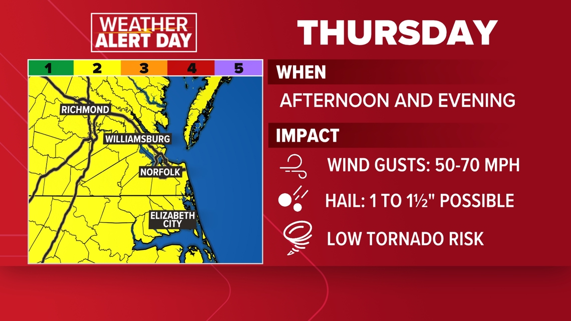
The unsettled weather pattern will persist into Thursday, with the best chances for showers and thunderstorms during the afternoon and evening as a strong cold front approaches. The Storm Prediction Center has the region under a Level 2 or Slight Risk for severe storms Thursday.

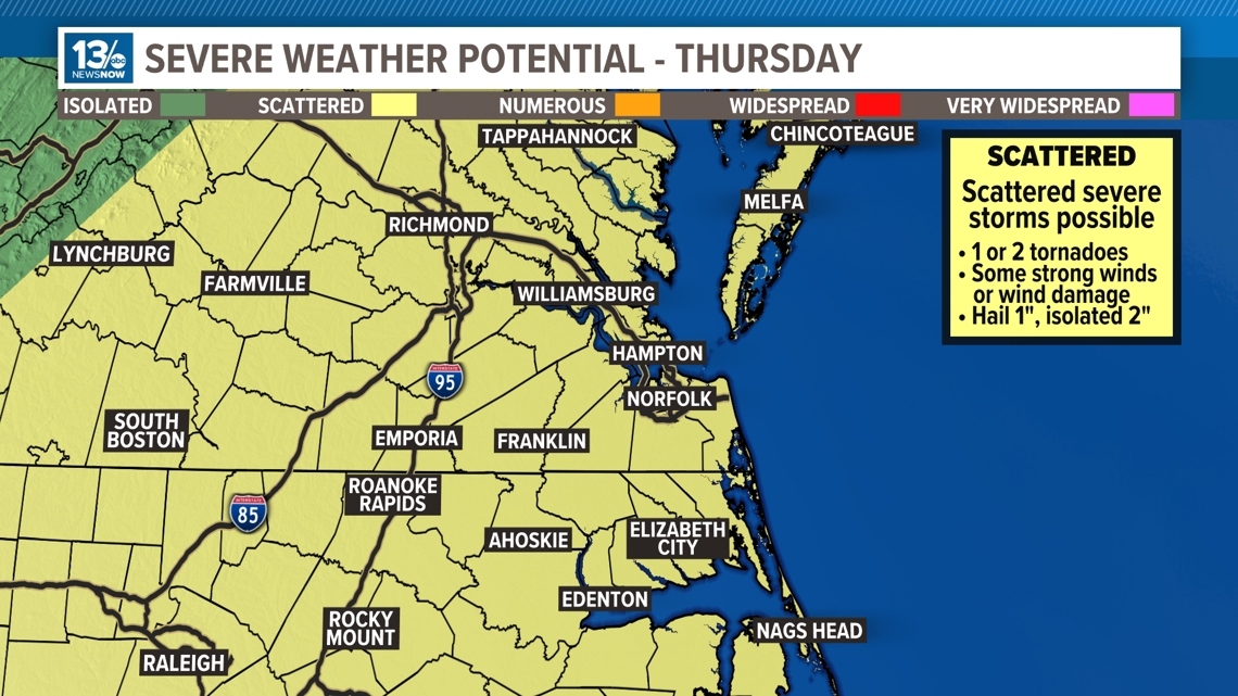
Because of the risk of severe weather, the 13News Now Weather Team has declared a "Weather Alert Day" for Thursday May 9th. With the heat and humidity in place, the atmosphere will likely support the development of strong to severe thunderstorms, with primary impacts being potentially large hail and damaging winds.

The strong potent cold front pushes to the coast Thursday night, dropping temperatures. A second cold front will move through the region Friday, producing another chance of more showers. Highs will be in the middle 70s.
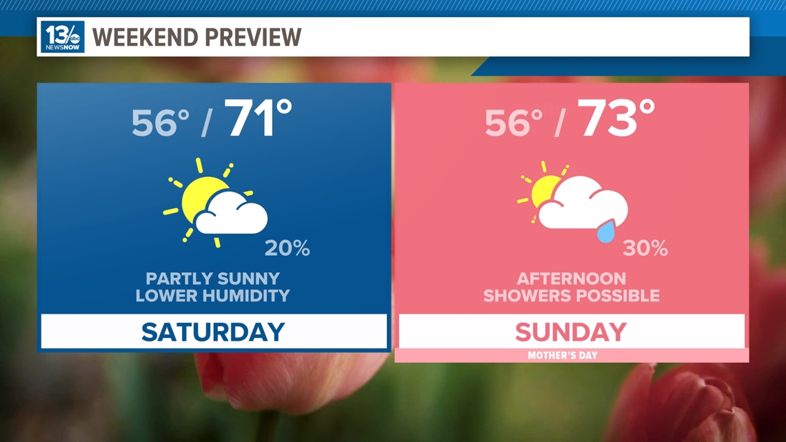
The weekend looks to be cooler and much drier, though there will be a slight chance of a shower both Saturday and Sunday afternoon. High temperatures will be in the lower 70s for Mother's Day weekend.

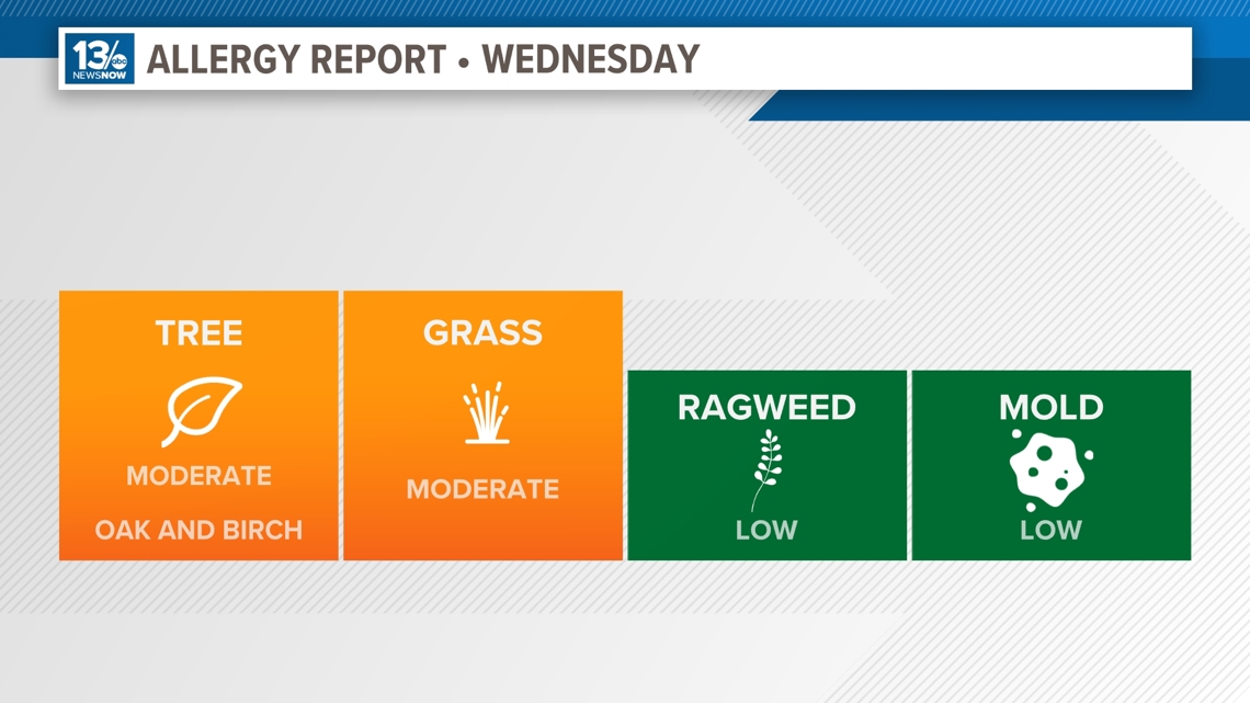
Allergy Report
Pollen levels will be moderate on Wednesday. Oak and birch tree pollen is the primary allergen.

Stay connected 24/7 via 13News Now